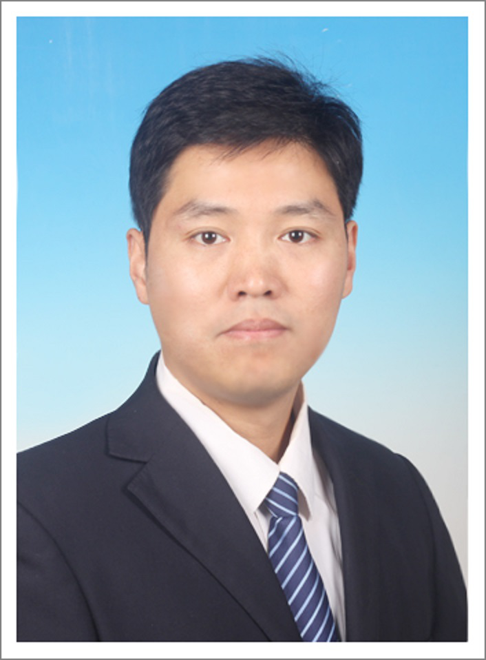
个人简介:
孙灏,教授、博士生导师
北京测绘学会青年科技创新人才、北京地理学会青年工作委员会副主任、中国矿业大学(北京)越崎青年学者、《遥感学报》《自然资源信息化》等青年编委。中国遥感应用协会热红外遥感专业委员会、中国环境科学学会生态遥感监测与评估专业委员会、中国测绘学会矿山测量专业委员会等委员。
主持国家自然科学基金面上项目、国家自然科学基金青年项目、北京市自然科学基金面上项目、国家重点研发计划子课题以及其他企事业单位委托科研项目等10多项。
在国内外重要期刊上发表学术论文60余篇,其中SCI论文40余篇(含多篇中科院TOP期刊论文以及JCR一区论文)。
已授权国家发明专利7项、软著1项、出版学术专著1部。
代表性科学技术奖一等奖4项、教育教学获奖6项
电子邮件:sunhao@cumtb.edu.cn
研究方向:
1. 生态环境遥感(土壤湿度、植被碳汇等)
2. 自然灾害遥感(生态干旱、地质灾害等)
代表性科研项目:
1. 国家自然科学基金面上项目,面向被动微波土壤湿度空间降尺度的物理知识引导机器学习机制研究(42471381),2025-2028,主持;
2. 国家自然科学基金面上项目,耦合两阶段梯形模式和再分析资料的微波遥感土壤湿度降尺度研究(41871338),2019-2022,主持;
3. 国家重点研发计划子课题,草原入侵植物的发生程度评估(2024YFC2607703-5),2024-2027,主持;
4. 国家自然科学基金青年项目,地表温度与植被盖度的两阶段特征空间模式及其参数反演方法研究(41501457),2016-2018,主持;
5. 北京市自然科学基金面上项目,耦合物理模型和机器学习的微波遥感土壤湿度降尺度研究(6222045),2022-2024,主持;
6. 北京市自然科学基金联合基金项目,北京山区森林生态干旱遥感智能识别与动态监测研究(L251050),2025-2028,主持;
7. 国家自然科学基金面上项目,面向城市场景的地表等效发射率方向性差异核驱动模型(41771448),2018-2021,合作单位主持人;
8. 宁夏回族自治区重点研发计划(一般项目),遥感数据驱动的宁夏沿黄城市带生态环境时空演变过程与扰动研究(2018BEG03069),2018-2020,合作单位主持人;
代表性科研获奖:
1. 2024,中国煤炭工业科学技术奖一等奖:矿区植被生态环境定量遥感关键技术及装备,排名2;
2. 2019,测绘科技进步奖一等奖,复杂地表热环境定量遥感范式、理论与方法创新,排名3;
3. 2025,北京测绘学会青年科技创新人才,排名1;
4. 2023,龙软科技教师贡献奖,优秀青年教师奖,排名1;
5. 2024,地理信息科技进步奖一等奖,天空地一体化建筑垃圾堆存体智能监测关键技术与应用,排名10;
6. 2018,地理信息科技进步奖一等奖,农村集体建设用地数字化监管技术研究,排名10。
代表性教学获奖:
1. 2024,全国煤炭行业教学成果奖,二等奖,排名1;
2. 2023,北京市普通高校优秀本科毕业设计,优秀指导教师,排名1;
3. 2022,全国高等学校测绘类专业教师教学创新大赛,二等奖,排名1;
4. 2021,北京市高等学校教师教学创新大赛,二等奖,排名1;
5 2021,全国高校GIS青年教师讲课竞赛,二等奖,排名1;
6. 2021,北京市高等教育教学成果奖,二等奖,排名13.
代表性论文:
1.T-ACD: A topography-aware change detection method for mapping high-resolution soil moisture with time-series SAR[J]. Remote Sensing of Environment, 2026, 342: 115486.
2.kNDMI: A kernel normalized difference moisture index for remote sensing of soil and vegetation moisture[J]. Remote Sensing of Environment, 2025, 319: 114621.
3.The high spatial resolution Drought Response Index (HiDRI): An integrated framework for monitoring vegetation drought with remote sensing, deep learning, and spatiotemporal fusion[J]. Remote Sensing of Environment, 2024, 312: 114324.
4.Series or Parallel? An Exploration in Coupling Physical Model and Machine Learning Method for Disaggregating Satellite Microwave Soil Moisture[J]. IEEE Transactions on Geoscience and Remote Sensing, 2022, 60: 4415015.
5.CPMF: An Integrated Technology for Generating 30-m, All-Weather Land Surface Temperature by Coupling Physical Model, Machine Learning, and Spatiotemporal Fusion Model[J]. IEEE Transactions on Geoscience and Remote Sensing, 2024, 62: 5008216.
6.A Study on Simulating Directional Land Surface Emissivity Based on Kernel-Driven Models and Its Application to the Generalized Split-Window Algorithm[J]. IEEE Transactions on Geoscience and Remote Sensing, 2026, 63: 5010724.
7.An evaluation of the response of vegetation greenness, moisture, fluorescence, and temperature-based remote sensing indicators to drought stress [J]. Journal of Hydrology, 2023, 625: 130125.
8.A pixel-wise calculation of soil evaporative efficiency with thermal/optical remote sensing and meteorological reanalysis data for downscaling microwave soil moisture [J]. Agricultural Water Management, 2023, 276: 108063.
9.Evaluating established deep learning methods in constructing integrated remote sensing drought index: A case study in China [J]. Agricultural Water Management, 2023, 286: 108405.
10.PhySoilNet: A deep learning downscaling model for microwave satellite soil moisture with physical rule constraint[J]. International Journal of Applied Earth Observation and Geoinformation, 2024, 135: 104290.
11.基于多时相SAR的矿区沉陷积水遥感监测方法研究[J]. 煤炭学报, 2026, 51(2): 1600−1618.
12.植被干旱遥感监测方法研究进展[J]. 遥感学报, 2024, 6(28): 1395-1411.
13.大型煤炭基地生态系统服务功能遥感评估及演变分析[J]. 遥感学报, 2024, 28(4): 926-939.
14.顾及岩土差异和植物多样性的矿区生态环境遥感监测模型 [J]. 煤炭学报, 2023, 48: 219-232.
